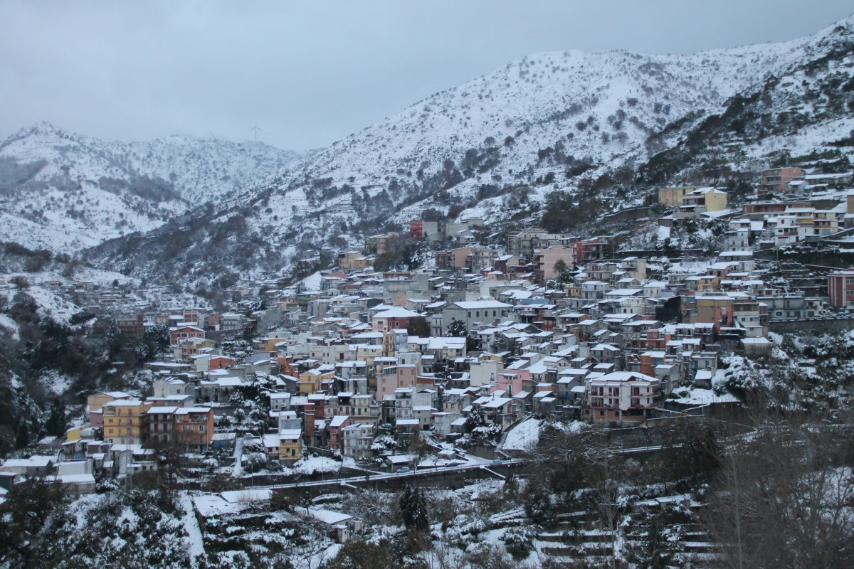

Antillo è posto ad una altitudine di circa m.480 s.l.m. tra est ed ovest e aderisce all'Unione dei comuni delle Valli joniche dei Peloritani.
Il nome “Antillo” arebbe di origine greca (primo fiore) o anche dal latino ante illus=avanti di quello: riferito a Casalvecchio; Tantillus= piccolino= tantiddu o anche senza la T= Antiddu.
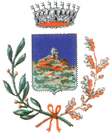
L'abitato si snoda su una collina sormontata da una roccia verticale (impressa nello stemma del Comune), che trae il nome dalla contrada sottostante “Contrada Castello” e pertanto denominata “Rocca Castello”.
Appartiene al tratto montano del bacino della fiumara d’Agrò ed è ricchissimo di boschi.
Secondo gli storici era abitato nella preistoria da pastorie allevatori, i Siculi.
Successivamente da Fenici e Sicelioti provenienti da Phoinix (SantaTeresa di Riva) e Naxos.
In origine era solo un piccolo borgo di pastori. Ma in seguito alle invasioni barbariche alcuni abitanti di Phoinix si spinsero verso tale luogo e lo chiamarono Peniz o Piniz, da qui il nome Pinazzo che ancora oggi indica una frazione di Antillo.
Nel 1139 fu istituita dal Re di Sicilia Ruggero II la baronia di Savoca e Antillo fu inglobata nella Terra di Savoca e divenne da essa dipendente fino al 1800 circa.
Savoca pretendeva dai casali, Antillo incluso, il debitum servitium cioè oneri personali e reali ma nel 1812 nel Regno di Sicilia fu emanata una nuova Costituzione che aboliva il feudalesimo e gli antillesi ebbero un po' di respiro da questa situazione. Nel 1820 la chiesa della Santa Vergine di Antillo fu elevata ad Arcipretura autonoma rispetto a Savoca e nello stesso anno fu istituita una delegazione municipale dotata di stato civile.
Grazie all'intervento di due antillesi: Bernardo Bongiorno (1812-1880) e il sacerdote Santi Lo Giudice (1822-1881) con un decreto di Ferdinando II Re delle Due Sicilie il 17 febbraio 1845, Antillo diviene comune autonomo inserito nel Circondario di Savoca (Distretto di Castroreale) ma da esso indipendente.
Aumenta finalmente il numero di abitanti. Nel 1888 fu ampliata la Chiesa Madre del 1750 (demolita nel 1936 per costruire quella attuale). Nel 1880 fu realizzato il cimitero e nel 1901 fu aperto l'ufficio postale.
L'attività prevalente era l'agricoltura ela pastorizia che divenne prospera nonostante la continua e forte emigrazione.
A metà del XX secolo Antillo supera i 2,000 abitanti ma progressivamente si assiste allo spopolamento.
Diverse sono le sue attrattive soprattutto le montagne, i boschi, i pascoli e il rinomato Giardino di Redenzione (sito web) realizzato dal parroco don Egidio Mastroeni nel 1985.
Da visitare è anche l'interessante Museo Agropastorale che ospita un cospicuo patrimonio etno-antropologico con oggetti rappresentativi della tradizione antillese rurale, pastorale e montana:
Ente gestore: Comune di Antillo, Via Roma
Tel. 0942723031
mail: comuneantillo@tiscali.it.
Ingresso gratuito su appuntamento.
Per informazioni: 0942723031 (Ufficio servizi sociali)
(English)
Antillo is placed at an altitude of about 480 m a.s.l. (above sea level) between east and west and it is part of the Union of the municipalities of the Jonian Valleys of Peloritani.
The name “Antillo” is supposed to be of Greek origin (primo fiore) or also from the Latin ante illus=ahead of that: referred to Casalvecchio; Tantillus=smallish=tantiddu or also without the T=Antiddu.
The village is situated on a hill topped by a vertical rock (engraved in the Municipality’s coat of arms), which takes its name from the district below it, “Contrada Castello” and is therefore called “Rocca Castello”.
It belongs to the mountain section of the Agrò river basin and is rich in woods.
According to historians it was inhabited in prehistoric times by shepherds and breeders, the Siculi. Later by Phoenicians and Siceliots coming from Phoinix (Santa Teresa di Riva) and Naxos. Originally it was just a small village of shepherds. But after the barbarian invasions some inhabitants of Phoinix moved towards this place and called it Peniz or Piniz, hence the name Pinazzo that still today indicates a hamlet of Antillo.
In 1139 the barony of Savoca was instituted by the King of Sicily Roger II and Antillo was incorporated in the Land of Savoca and became dependent on it until about 1800. Savoca demanded from the hamlets, including Antillo, the debitum servitium, that is, personal and royal burdens, but in 1812 in the Kingdom of Sicily a new Constitution was issued which abolished feudalism and the people of Antillo had some respite from this situation.
In 1820 the church of the Holy Virgin of Antillo was elevated to an autonomous Archcourt compared to Savoca and in the same year was established a municipal delegation with civil status.
Thanks to the interventation of two Antillesi: Bernardo Bongiorno (1812-1880) and the priest Santi Lo Giudice (1822-1881) with a decree of Ferdinand II King of the Two Sicilies on 17 February 1845, Antillo became an autonomous municipality inserted in the Savoca District (Castroreale District) but independent from it.
The number of inhabitants finally increased.
In 1888 the Mother Church of 1750 was enlarged (demolished in 1936 to build the present one).
In 1880 the cemetery was built and in 1901 the post office was opened.
The main activity was agriculture and sheep-breeding, which became prosperous in spite of the continuous and strong emigration.
In the middle of the XX century Antillo exceeded 2,000 inhabitants but progressively depopulated.
There are several attractions, above all the mountains, the woods, the pastures and the renowned Garden of Redemption (website) created by the parish priest don Egidio Mastroeni in 1985.
To be visited is also the interesting Agropastoral Museum that hosts a conspicuous ethno-antropological heritage with objects representing the rural, pastoral and mountain Antillo tradition.
Managing body: Municipality of Antillo, Via Roma
Tel. 0942723031
mail: comuneantillo@tiscali.it
Free entrance by appointment.
For information: 0942723031 (Social Services Office).